-40%
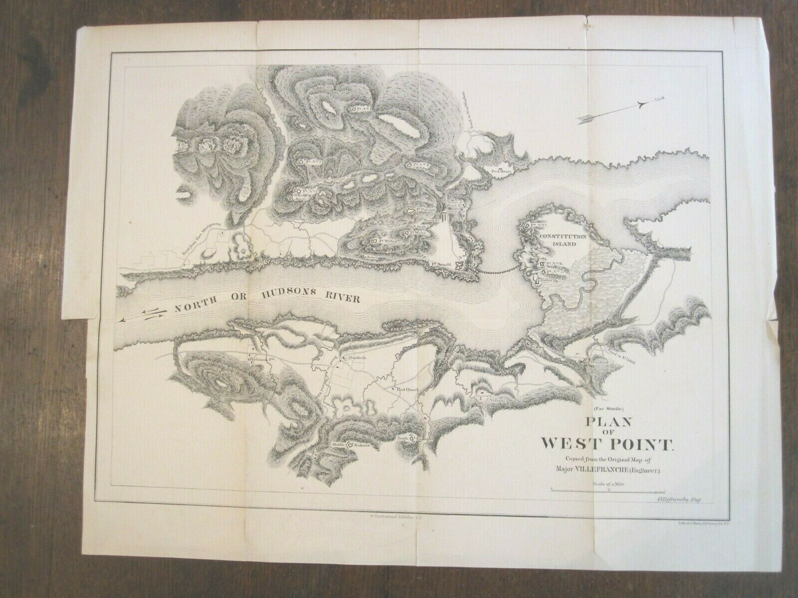
19th Century West Point Map by Major VILLEFRANCHE - "PLAN OF WEST POINT"
$ 71.27
- Description
- Size Guide
Description
19th Century West Point Map by Major VILLEFRANCHE - "PLAN OF WEST POINT"A used (fac simile) as it states on the map - this was removed by a book at some point and was a fold-out map.
Condition is used, creases here and there, some discoloration in the folds, creasing, tears in edge folds from careless handling in the past.
Size is 17 x 13.5"t.
This will frame up quite nicely.
It will be shipped folded.


